Friday, 3 June 2022

The London 1960 Cube is coming any day now

A quick post to share a box making project not involving a bus! This time it’s a map and it is a few days away from completion. My first cube map dates back to 2017, but it was less than perfect. Recently I made a cube map of Beeston open gardens and, by chance, realised how I could create a cube map of the London railways I knew and used in the fifties and sixties before leaving Wembley for Birmingham in 1969, arriving in Lenton in Nottingham ten years later, where I have lived ever since.

This cube map is about the world I grew up in and fell in love a few times, went to work in, all with the help of London Transport. More later. In the meantime, a teaser to look at:


P.S. The story of these years can be found on another blog of mine at:

mywembley.blogspot.com


Monday, 25 April 2022

Beeston Fields has it only little map. complete with bus info

 This small A5 landscape map first saw light of day in early-2019 and a few things have changed since then. Not least, the Beeston Fields Estate has lost its Monday-Saturday half-hourly bus service into Beeston town centre. Now we have just three journeys each way on Mondays and Thursdays, thanks to local government budget cuts.

I live in Beeston Fields, so know the estate quite well. I use the post office on Central Avenue when I need one and I visit The DoughMother Bakery and CafĂ© every week for a few hours to read and write. I also walk around Beeston Fields Recreation Ground regularly. 

It's a friendly estate and even with our regular estate bus, we are no more than ten minutes walk from high frequency bus services along the Derby and Woodside roads, and the town centre is just as close and, there, we can catch the tram as well. 

Nottingham City Centre is, even with the walk, within 35 minutes if you don't have to with for a bus and Derby City Centre is an hour away door-to-door. In other words, Beeston Fields is a good place to live.

Anyway, here is my update map. None of the shops on Central Avenue have changed since 2019 with the exception of one closure. It's much the same at the Priory Island shops.

The map has been designed so to is easy to read and there is a folded postcard in the process of being prepared for printing. I'm just waiting for an advert.

CLICK ON THE IMAGE TO ENLARGE.


Friday, 15 April 2022

I am a lover of trees and I have an image in my head of Nottingham City Transport's 36 bus and Trent-Barton Indigo travelling along a corridor of trees as they travel through Beeston. I hope the attached will tell you more:

The first image is of a banner being made for me for two events in Beeston later this month. Once I have more details I will share them with you. The second and thirds images are two sides of a leaflet which will accompany the banner when it is on display and, finally, an enlarged version of the sketch map I originally created in June 2020.

I describe my vision 'Creating Green Corridors'. Click on each image in turn to enlarge. I also hope to take them into Beeston High Road when there are nice days. Just turn up and pull up my banner with a small table for my leaflets.


Wednesday, 23 March 2022

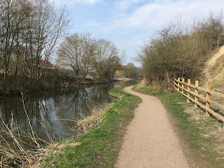
The historic Bennerley (railway) Viaduct sandwiched between two canals

Well, posting a map has taken a little longer than I intended but a lot has happened — two eye cataract operations within four weeks of another at short notice. I have for several months been having problems with my vision and I finally went to my optician two months ago as good as, who told me I had a cataract on my left eye and wrote to my GP. Within three days I was invited to attend a pre-op appointment and I had the operation a fortnight later. The surgeon told me that there was a cataract on my right eye as well and I was offered a cancellation three weeks after my left eye was done. It still isn't a fortnight since my second op, but I have had a post-op check and told I now have 20-20 vision and all I needed was a pair of reading glasses, so here I am back at the computer and the map completed.

I have created the map so that it can easily be captured and printed off. I have just done it and have a perfectly readable A4 page in front of me. If you can find the leaflets referred to, then great, but you don't need them. There is plenty of signage along the Erewash Canal and by Bennerley Viaduct.

CLICK ON THE IMAGE TO ENLARGE.


For the moment just enjoy the pics (yet to be put in geographical order) and explore the weblink with The Friends of Bennerley Viaduct

A map showing frequent Trent-Barton daily bus links and my text will follow on Saturday, other than to say Susan and I took our first walk across Bennerley Viaduct yesterday after years of seeing it from the Erewash and abandoned Nottingham canals. Thanks to FoBV it has recently opened as a foot and cycle path.